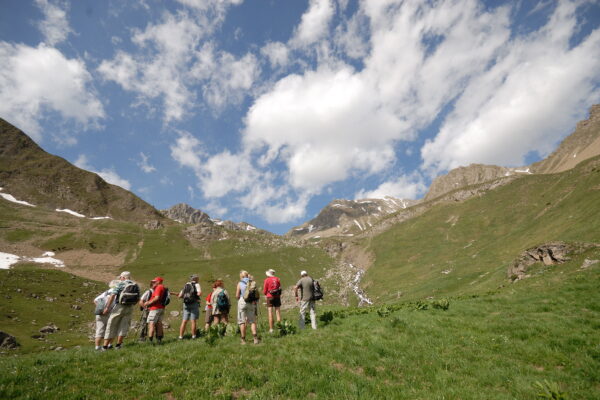
Hiking
Wild but accessible nature in our welcoming mountains!
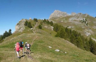
From the Réallon resort, take advantage of the panoramic chairlifts to reach the Serre du Mouton ridge. A breathtaking panorama of the Serre-Ponçon fjord, the Ecrins National Park and the Aiguilles de Chabrières. Let yourself be tempted by this aerial hike and set off to conquer this emblematic Serre-Ponçon mountain.
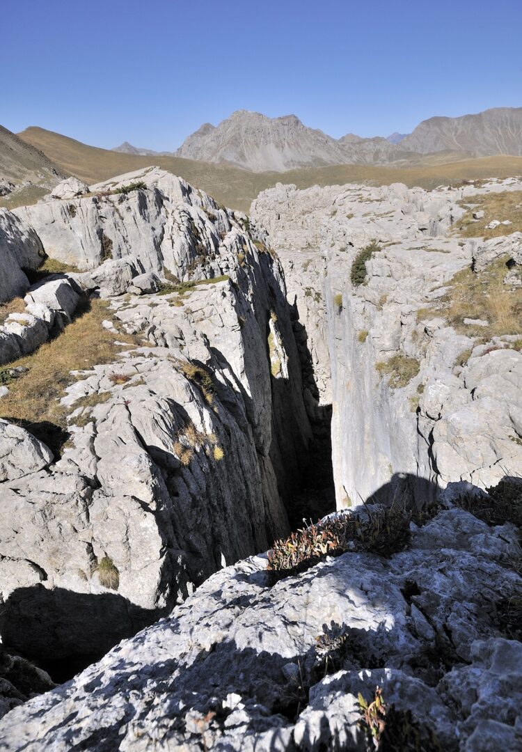
This summit, made up of several sharp needles, is like no other. A very "mountain" feel and atmosphere, but no real difficulties. The steep but short ascent of the Brèche de Chabrières, right in the heart of the Aiguilles, is a feast for the eyes. Then comes the strange discovery of the Oucanes, a veritable maze of limestone crevasses. A hike you won't soon forget!
From the brèche, access to the Aiguilles summit is possible, but the route is steep and unmarked. Not recommended for children.
Réallon's panoramic chairlifts offer a gentle way to discover the mountain. From the Serre du Mouton ridge, a number of other downhill trails lead to the resort, where you can relax and enjoy a meal on the sunny terraces.
Ecrins National Park
Created in 1973, after having been prefigured in 1913 under the impetus of mountaineers, naturalist associations and the Club Alpin Français, the Parc national des Écrins is one of France's ten national parks. This high-mountain territory culminates at 4102m altitude, at the Barre des Écrins, and marks the geographical and climatic boundary between the northern and southern Alps.
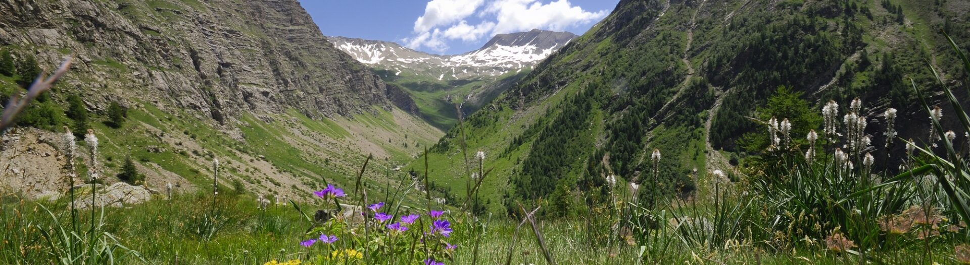
Serre-Ponçon is the Park's southernmost sector. Here, the peaks flirt with 3000m altitude and have their feet in the water. As a result, hikers can move from the Mediterranean influence to the nival zone, encountering a wide variety of flora and fauna.
For itineraries in the heart of the Ecrins National Park, please consult the Ecrins National Park regulations.
Other ideas for walks and hikes:
Hiking from the Réallon resort
- The Aiguilles de Chabrières
Departure point : Resort parking lot - Duration : 4h30 - Difficulty : Medium - Difference in altitude : 849m - Loop
A varied hike through woods, cattle and sheep pastures, and rocky outcrops, with beautiful views of Lac de Serre-Ponçon, the "Oucanes" and the Aiguilles de Chabrières. Beware of mountain terrain!
From the parking lot, take the Joubelle forest track. Turn left after a hairpin bend and continue for about 500m.
- Then take a path to the right, which rises quickly through the woods; it is marked with an orange dot and another blue dot. Cross the Serre du Mouton mountain pasture (note that signposting is not always correct). After levelling out, the path climbs again to an open ridge, from which you can see Lac de Serre-Ponçon.
- The route follows the ridge that leads to the top of the Chabrières chairlift and an orientation table. Continue on the clearly visible path (now marked only with a blue dot) which descends slightly and continues on a balcony to reach the foot of the couloir to be climbed up to the Brèche de Chabrières (2280 m). The path continues upwards to the ridge overlooking the Gapençais basin. From here, it takes 15 minutes to reach the summit of Chabrières (steep, unmarked route, not recommended for children). The path skirts the oucanes and descends to the Rougnous plateau, which it crosses. You can start the hike by taking the Panoramic Chairlifts, thus "saving" 600 meters of ascent.
- It then winds down into a valley and joins a path leading from the Font-Renarde hut, visible below. Continue on this path and join the ski slopes leading to the parking lot.
Rando Serre-Ponçon > Les Aiguilles de Chabrières
- The Réallon panoramic trail
Departure point : Resort parking lot - Duration : 2h30 - Difficulty : Easy - Altitude difference : 190 m - Round trip
Take the path behind the Aurans residence up to the chalets (panoramic trail). At the Pra-d'Ayme crossroads, leave the downhill path on the right and climb the left-hand path. After a panoramic traverse of the Réallon valley, continue along the flanking path to the Aigue Noire ski lift and the chalet.
Cross the clearing dotted with larches and hutches on the flank, then descend to the Posette intersection. Leave the track on your right (Les Mallets) and take the one opposite (Vaucluse, la Pourrachière). After 100m (information table no. 6), leave the track and take the grassy path to the right, which initially runs alongside the stone wall.
Cross the torrent du Bessuilier and climb up to the crossroads just after the first 2 chalets de Vaucluse.
Turn left and join the track above.
Turn right (La Pourrachière, Le Bourget) and follow the slope to information table no. 7, 50 m after the last chalet.
- Lake Saint Apollinaire
Departure point : Resort parking lot - Duration : 2h30 - Difficulty : Easy - Difference in altitude : 300 m - Loop
The Joubelle trail (forest road) runs deep into the mélézin. Follow it for 1/2 hour until you see the "Lac de Saint Apollinaire" sign.
Take the narrow path down to the lake. From the lake, follow the tarmac road for a while until you reach the GR (on the left).
Follow this GR back to the resort (chemin de Faysses).
You're on a balcony overlooking Lac de Serre-Ponçon in a larch forest. At Lac de Saint Apollinaire, you'll find tables and barbecues, pedalos, mini-golf and a snack bar with a panoramic terrace.
- La Croix du Vallon
Departure point: Réallon resort parking lot - Duration: 4 hours - Difficulty: Medium - Difference in altitude: 600 m - Loop
Take the wide track that climbs northeast then northwest near the Courtier ski lift. Pass under the Aigue Noire ski lift and climb to Sous Font Guillarde. Leave the track to the right and stay on the main track, passing just below the reservoir. Follow this track to the top of the estate and then to the orientation table. Descend on the Serre du Mouton trail, which runs along the ridge for a while, with Lac de Serre-Ponçon in sight. At the next junction, continue downhill on your left, leaving the path on your right towards the Cabane de Joubelle and Lac de Saint Apollinaire. The path continues through the forest and then drops down to the Joubelle forest track. Turn left to reach the Réallon resort parking lot.
- La Cabane de Font-Renarde
Departure point: Réallon resort parking lot - Duration: 3 hours - Difficulty: Easy - Difference in altitude: 300 m - Loop
Take the wide track that climbs northeast then northwest near the Courtier ski lift. Pass under the Aigue Noire ski lift and climb to Sous Font Guillarde. At the crossroads, turn right following the blue tracks. Near a sheepfold, leave the wide track for a much wilder path (there are still blue tracks). After a short descent, find the Font Renarde hut. After the hut, continue north. At the next crossroads, turn right in the direction of Vaucluse. Join the GR50 on the right, heading south-east. Stay on this GR, known as the "Sentier Panoramique". Leave the GR and turn right onto a path that leads back to the station and then to the parking lot.

Hikes from the main town of Réallon
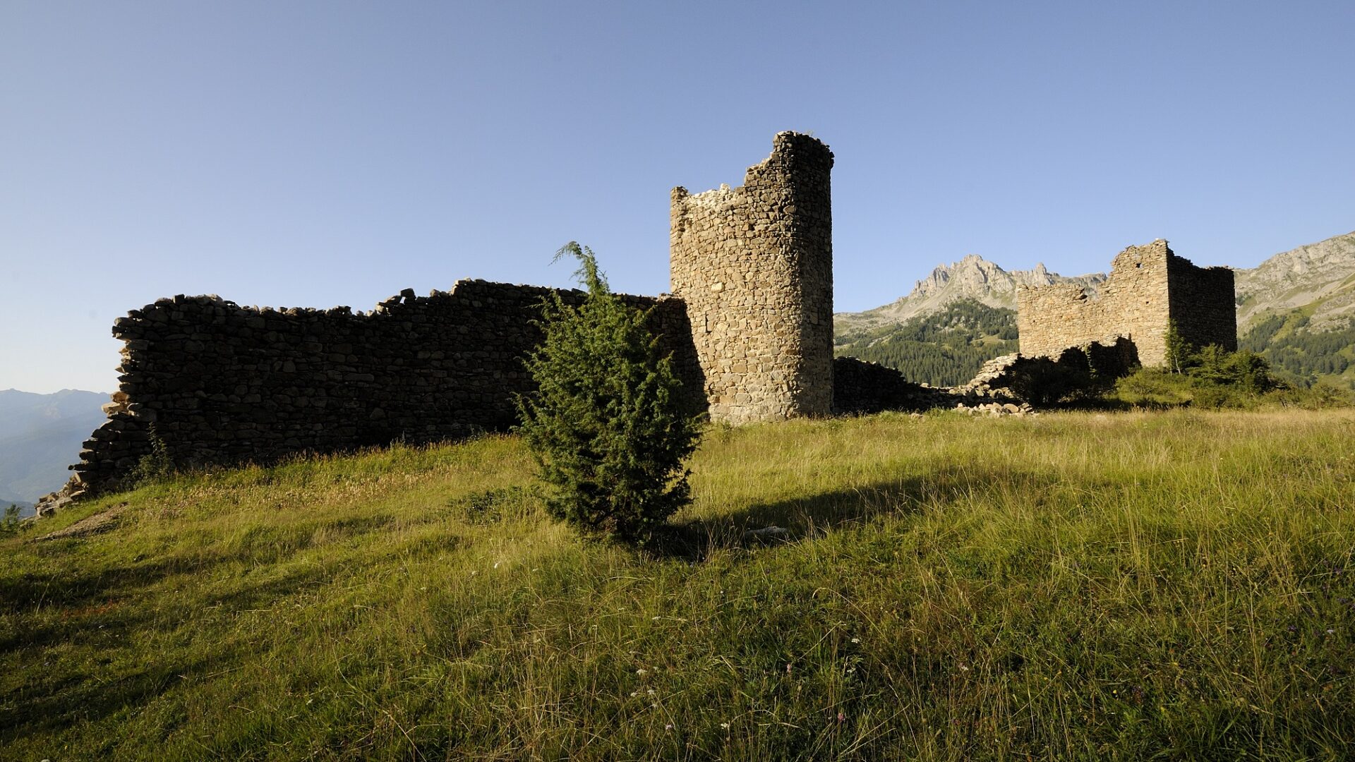
- Le Fort de Réallon
Start: Parking de la Coste / Village de Réallon - Duration: 1h / 2km - Difficulty: Easy - Difference in altitude: 175m - Round trip (via the GRP)
A short climb above a picturesque village... Winding road after winding road, an increasingly dazzling panorama until you reach an unsuspected plateau.
- From the parking lot, follow the course of the torrent de la Pisse, channelized at the bottom by a dyke that protects the village of Réallon. On the left, observe the remains of low walls that bear witness to former terraced farming.
- Continue left along a path that twists and turns through a small forest of oaks and pines.
- At the next intersection, take the right-hand path and continue to the fort.
- The return journey takes the same route.
Arriving at the Fort, it's a delight to open up onto a vast meadow plateau. The panorama, from the Barle summit to the Serre Ponçon lake, is magnificent. To the north, a peak with steep, dry slopes stands out: Roche Méane, at an altitude of 2,650 m!
Hiking in Serre-Ponçon > Le Fort de Réallon
- Sentier des Terrasses
Departure point : Parking de la Coste / Village de Réallon - Duration : 1h30 / 5km - Difficulty : very easy - Difference in altitude : 182m - Loop
Family outing to discover Reallon's heritage
- From the parking lot, take the bridge. At the next junction, turn left. Go past the houses to the end of the road.
- At the far end, take the path opposite. After passing the Maou Riou stream, descend along the stream in the undergrowth.
- Continue downhill, then at the next junction turn right onto the GR path.
- On the road, turn right. At the "Charrière de la pisse" parking lot, take the road on the right towards Eglise St- Pélade to return to the Coste parking lot.
From the village of Réallon, follow the grazing mountainside. This is an itinerary that will plunge you into a pastoral atmosphere through agricultural terraces worthy of the most beautiful landscapes of Serre-Ponçon. Around a bend, you'll come across the Maou Riou torrent before returning to the vast meadows.
Hikes from Les Gourniers
- Les Gourniers discovery trail
Departure point: Parking des Gourniers - Duration: 30 minutes / 1km - Difficulty: Very easy - Loop
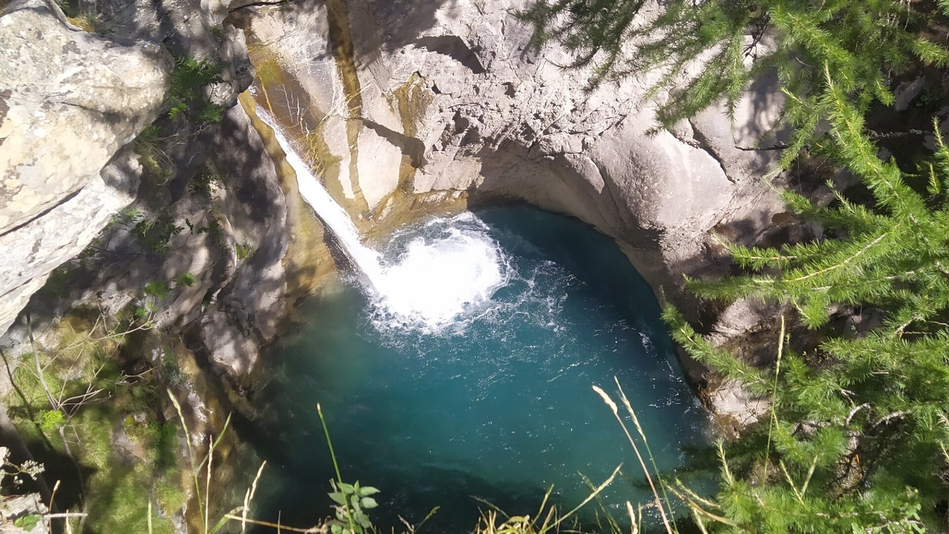
Interpretation trail with reading tables and botanical labels, around the hamlet of Gourniers and its "giant's pot".
At the parking lot on the right before the bridge, a sign describes the route. To the right, take the stone staircase leading to the path. Continue along the road to the end of the field, then turn left uphill. Along the way, reading tables help you discover and understand the valley's landscapes.
- Continue straight on to the foot of the Pissarotte waterfall (15 mins).
- Cross the footbridge over the torrent and return to the top of the hamlet, not forgetting to descend to the left at the lookout point overlooking the Giant's Pothole.
- After passing a house, turn left to go down into the hamlet and reach the parking lot.
Ideal for a walk with the kids followed by an ice cream.
Rando Serre-Ponçon > The discovery trail
- The Pré d'Antoni hut
Start : Parking des Gourniers - Duration : 2h30 / 9km - Difficulty : Easy - Difference in altitude : 448m - Round trip
As the path winds its way along, the fresh grass of the verdant meadows seduces the hiker, who is quick to take a rest.
- From the Gourniers parking lot, cross the hamlet and follow the path to Chapelle-Saint-Marcellin.
- The path then follows the slope to a footbridge (Pont la Claie) and then climbs back up to the Pré d'Antoni hut.
- The return journey takes the same route.
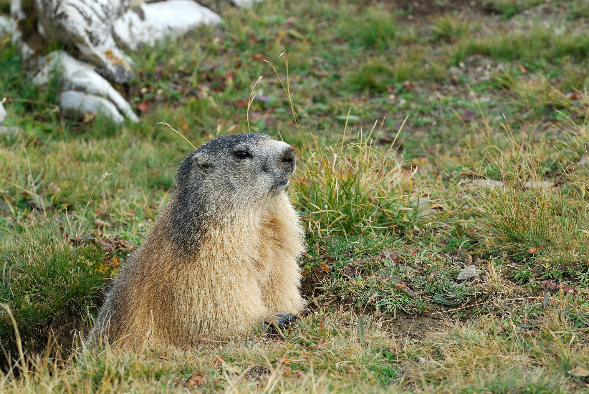
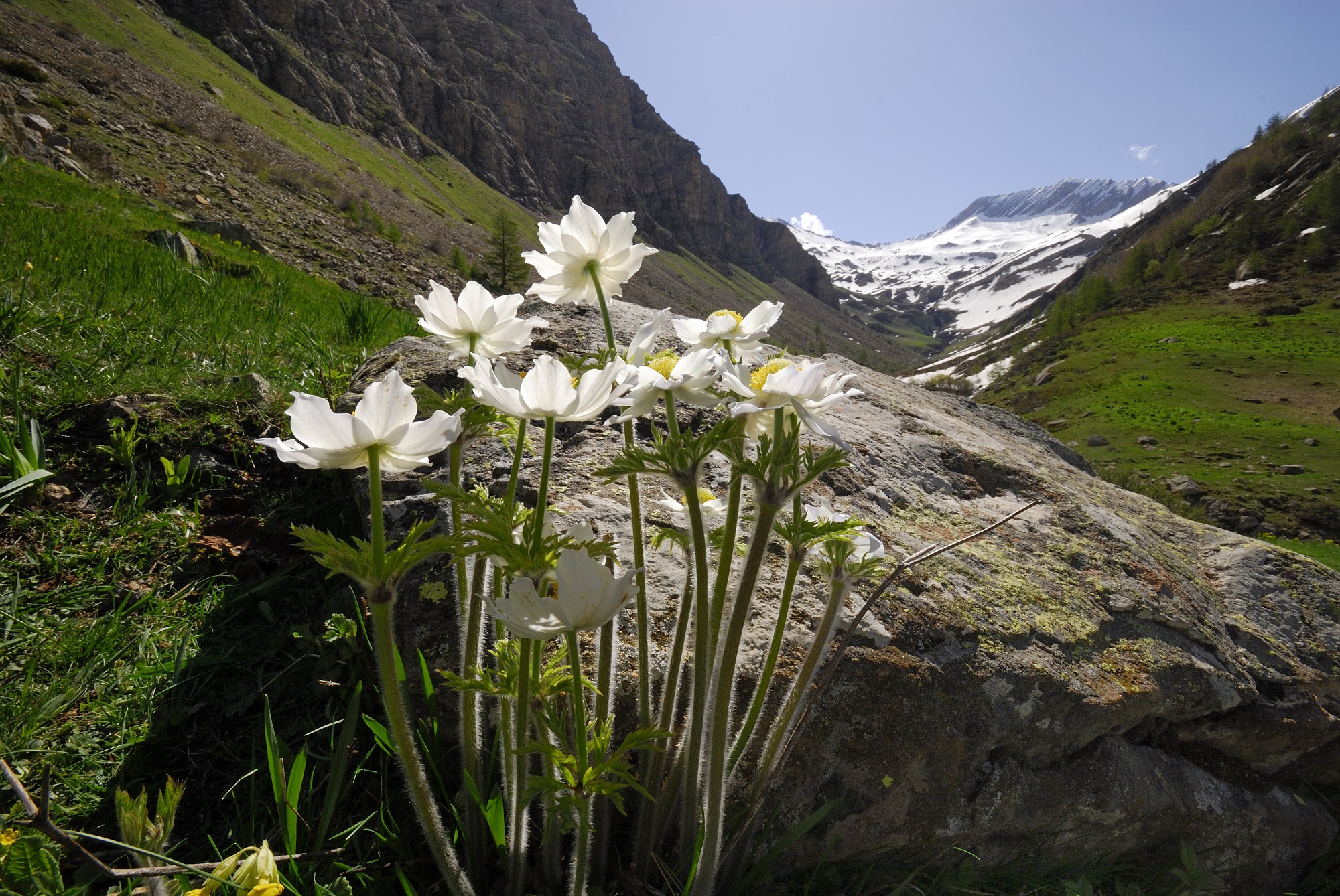
In the valley of contrasts and water, each spring flower brings its own note. On the way to the Chargès cirque, a gentle melody echoes in the air as the herds graze peacefully. Stealthily, a few chamois can be seen in the hollows of the green slopes.
This itinerary is in the heart of the Ecrins National Park. Ecrins National Park regulations.
Go further > The Chargès spring
- The Oussella loop
Start : Parking des Gourniers - Duration : 3h / 7km - Difficulty : Easy - Difference in altitude : 417m - Loop
From the parking lot, cross the bridge, and at the hamlet crossroads head towards Chargès, up the street to the last house.
- Take the path on the right towards l'Oussella
- After the Marmite de Géant and the bridge, continue left towards Oussella. Cross the waterfall stream and keep to the main path through the beech forest. After a few hairpin bends, at the end of the melezin, cross the old hay meadows and a stream. Cross the ravine and the torrent de la Pissarotte to reach the foot of another area of old meadows, which must be climbed (cairns and arrow).
- Turn right and follow the road to the crossroads (post) at the end of the climb and viewpoint. Follow Les Gourniers via Le Villard. Pass the old alpine chalets and Fouents (viewpoint) and descend to Le Villard. Follow the edge of the ravine to the post (right arrow). After the series of hairpin bends, turn right into the field before the drinking troughs and left again 50 m further down (small arrow post). Go alongside a stony hutch and continue along a series of small switchbacks (cairns). Cross the combe and join the fort path.
- Take the path on the right towards Les Gourniers.
- When you reach the track, follow Les Gourniers to the right (red and white GR markings).
- At the top of a rise, leave the track and continue straight ahead (post with arrow). Stay on the GR until you reach the road back to the parking lot.
A pleasant family hike in a loop with a beautiful view over the Réallon valley.
Rando Serre-Ponçon > Oussella loop
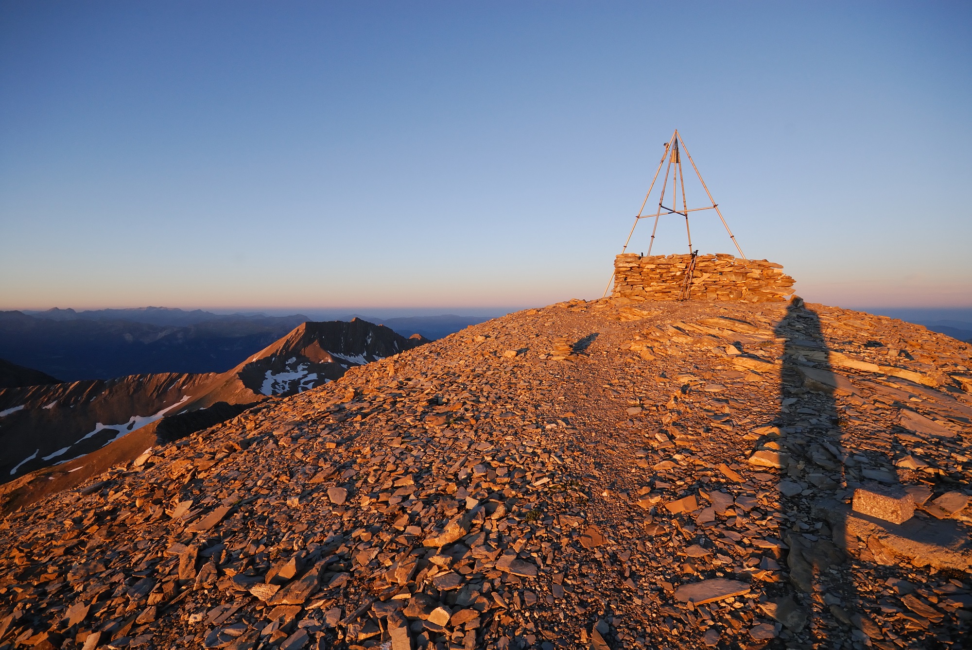
- The Oussella balcony and the Quille du Laus
Start : Parking des Gourniers - Duration : 6h/ 11km - Difficulty : Medium - Difference in altitude : 898m - Loop
An itinerary to discover the Quille du Laus, and the panorama it offers towards Réallon and Serre-Ponçon.
From the parking lot, cross the bridge, and at the crossroads at the entrance to the hamlet, follow signs for Chargès up the street to the last house.
- Take the path on the right towards Oussella.
- After the marmite de géant and the bridge, continue left towards Oussella. Cross the waterfall stream and keep to the main path through the beech forest. After a few hairpin bends, at the end of the larch grove, cross the old hay meadows and a stream. Cross the ravine and the torrent de la Pissarotte to reach the foot of another area of old meadows, which must be climbed (cairns and arrow).
- At the crossroads, turn left towards Le Laus.
- Turn left
- At the sign indicating the entrance to the heart of the PNE at a grassy collet, turn left on the ridge to the large cairn.
- Turn around and head back down to the Oussella loop junction.
- Head towards Les Gourniers via Le Villard. Go past the old alpine chalets of Les Fuents (viewpoint) and descend towards Le Villard. Follow the edge of the ravine to the post (right arrow). After the series of hairpin bends, turn right into the field before the drinking troughs and left again 50 m further down (small post with arrow). Continue along a stone-pelting hutch and follow the small switchbacks (cairns). Cross the combe and join the fort path.
- Take the path on the right towards Les Gourniers.
- When you reach the track, turn right at Les Gourniers (red and white GR markings).
- At the top of a rise, leave the track and continue straight ahead (post with arrow). Stay on the GR until you reach the road back to the parking lot.
From the coolness of the beech and larch woods, through ancient hay meadows and the ruins of former alpine chalets, the trail then climbs to a balcony overlooking the Réallon valley. The final ascent to the Quille du Laus, a large cairn built on a high point, overlooks the deep gorge of the Chargès torrent on one side and the small Laus lake nestling in a valley on the other...
Rando Serre-Ponçon > Boucle de l'Oussella and Quille du Laus
- The Col de la Coupa
Start: Parking des Gourniers - Duration: 5h / 9km - Difficulty: Medium - Difference in altitude: 815 m - Round trip
This valley, where a herd of ewes graze, leads to the Col de la Coupa, a passageway between the Réallon and Rouane valleys that joins Ancelle in the Champsaur.
- From the Gourniers parking lot, cross the bridge over the Réallon torrent and take the tarmac road to the left. Follow this road for 1 km until you reach the end of the asphalt road at Les Tomelles.
- Take the path to the right.
- At the next fork in the path, turn right and follow the path through the mélézin to the torrent de la Gorge.
- Ford the river 3 times for about 500 m and end up on the adret, on the left bank, in the pastures. Reach a flat spot and climb the slope to the right.
- Walk past the shepherd's hut. From here, the path is faint, but the pass is clearly visible to the north-west. Follow the slope, which rises steadily, to find the winding path leading to the pass.
- The return journey takes the same route.
"Throughout the summer season, the presence of griffon vultures makes this hike attractive. In the morning, around 9 a.m., they leave the cliff to the right of the pass, gain altitude and disperse. Throughout the day, they soar over the surrounding peaks and ridges. The end of the day is a good time for observation as they return to their "dormitory". It's a good idea to pack a picnic lunch for the evening and the descent before dark."
Mireille Coulon, guard-monitor in the Embrunais region
Hiking in Serre-Ponçon > The Coupa pass
- The Col de la Gardette
Departure point : Parking des Gourniers - Duration : 5h30 - Difficulty : Medium - Difference in altitude : 700 m - Loop
Follow the red markers along this trail.
From Les Gourniers, cross the torrent and turn left at the top of the hamlet. Follow the asphalt road for 1km to the hamlet of Les Tomelles. Climb to the right to reach Les Usclas on a slightly steep path. Continue left along the steep path to Les Clots at the edge of the forest (altitude 1950 m). The path rises gently through the alpine pasture, passing over rocky bars and arriving on a flat area at the Gardette hut at the foot of the Pousterle summit. Head south again to reach the Col de la Gardette (2125 m).
Return via the Gardette valley. Stay on the valley path and pass the Cabane de Corbières (1880 m). From here, follow the track under the Rocher de la Roudourière cliff to Pourrachière. Take the path down below the turnaround. A steep slope leads to Les Granges. Continue straight ahead towards the "La Baracane" campsite. In a few minutes, you'll find a track to the left. Pass close to the Cure bridge. Stay on this bank of the torrent and follow it for about twenty minutes to return to the Gourniers bridge.
Lovely hike in the Gardette mountain pasture, with panoramic views over the Réallon valley, the surrounding high peaks and Lac de Serre-Ponçon.
More hiking ideas around Réallon on: rando-serreponcon.com
BEFORE SETTING OFF ON A MOUNTAIN HIKE:
- Check the weather forecast for the Hautes-Alpes: +33 (0)8 99 71 02 05
- Inform your family or host of your itinerary
- Equip yourself with: good walking shoes, warm waterproof clothing, sunglasses, hats, water bottles, snacks and sun cream.
- Don't take shortcuts: leaving a path is the best way to get lost.
- We strongly advise you to bring an IGN TOP 25 map Ref.3437 ET, 3438 ET
So that everyone can enjoy the beauty that nature has to offer, let's respect it!
Attention : interdiction des chiens sur les alpages de Réallon
Face à la problématique du loup les éleveurs emploient des chiens de protection des troupeaux et pour éviter des conflits d’usage avec les randonneurs, la présence d’autres chiens sur les alpages de Réallon est interdite (alpage de Reyssas, du Laus, du Vallon, de Prunières, de la Gardette, de Font Renarde/Les Rougnous/Chabrières) . Arrêté municipal d’interdiction applicable du 15 juin au 15 octobre.
La randonnée est néanmoins possible avec un chien sur les itinéraires suivants : Fort de Réallon, piste de Joubelle.

JMartini - Raquettes
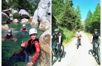
After a ten-year career as a professional firefighter, my passion for the mountains took over. So it's only natural that I should be your guide, whether on snowshoes, canyoning or mountain bikes, to help you discover this world through the seasons.
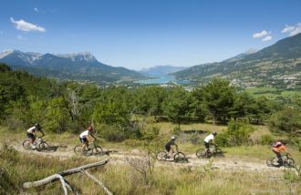
Ecole VTT - Horizons tout Terrain - Bureau Montagne
HORIZONS TOUT TERRAIN: ÉCOLE VTT mais pas que ! Discover our MOUNTAIN BUREAU: VIA-FERRATA - CLIMBING - CANYONING - HIGH MOUNTAINS - RIVER WATERS (rafting, hydrospeed, airboat) TRACTICAL SHOES - WATER SKIING - ACCROBRANCHE -
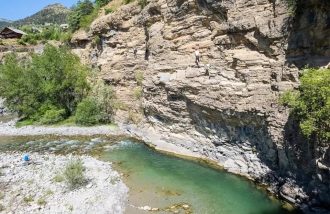
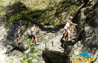
Roc Aventure Via ferrata et Tyrolienne
Cross the Durance on a 200m-high, 500m-long zip line in the form of a round trip. Discover our many via ferrata routes with footbridges, offering a wide choice of levels to suit everyone. Accessible from age 4.
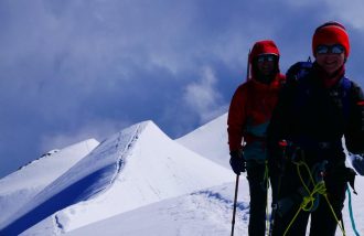
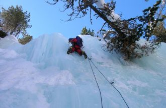
Guide Hautes Alpes - Didier Nicard
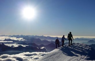
High mountain guide. All year round, beginner or advanced, discover mountaineering, climbing, off-piste skiing, ski touring or raid skiing, ice climbing or via ferrata. Snow avalanche trainer: preparing to go out safely.
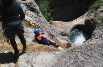
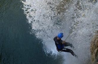
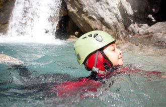
Guide Canyon Rafting - Patrick Guillamet
Accompanied by Patrick Guillamet, a guide with over 30 years' experience in white water, discover 4 canyons near the Lac de serre-Ponçon to try your hand at canyoning or rafting. For beginners and experienced sports enthusiasts alike.